Greensee 
Sustainability with impact
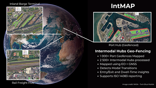
GEOCE
AI-Powered Shipment Visibility for Smarter Logistics
A Greensee geospatial intelligence module that generates precise geofences and spatial insights to support modern supply chain operations and infrastructure analytics.

What is GEOCE?
GEOCE is Greensee’s AI-powered geospatial intelligence module to let anyone create, improve and operate its geofencing solution. It generates structured polygon boundaries directly from maps, supporting logistics visibility, spatial analytics, and infrastructure mapping.
By converting map interaction into structured geospatial data, GEOCE simplifies GIS workflows and enables accurate operational zoning for ports, terminals, and logistics infrastructure.
Key Features
> Automated Geofencing
Generate precise geofence boundaries (polygons) instantly using AI-powered spatial detection.
> Self-service geo-fencing
Define operational zones for terminals, yards, industrial facilities, logistics hubs and any warehouse or building in the world.
> Structured Geospatial Data
Produce clean polygon geometries ready for GIS platforms, spatial databases, and analytics systems.
> Operational Integration
Export your custom polygons to your logistics platforms, tracking systems, and spatial analytics workflows.
Why Choose GEOCE?

> Berth-Level Port Coverage
Major commercial ports are already geofenced at berth level, enabling precise maritime and terminal location intelligence.
> AI-Powered Boundary Detection
Automatically detect and generate operational geofences from spatial data and map interaction.
> Structured Polygon Data
Access clean geospatial boundaries designed for GIS platforms and spatial analytics systems.
> Custom Solutions with Greensee Modules
Combine GEOCE with other Greensee modules to build tailored solutions that address specific operational and logistics challenges.
Resources

Discover use cases and real-world applications of GEOCE across logistics, infrastructure mapping, and geospatial analytics.


